
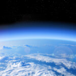
With the sun still not due to rise there until March 20, the North Pole should be one of the coldest and most inhospitable places in the world.
But a strange and disturbing phenomenon struck the planet’s tip on the weekend of February 24-25: temperatures may have soared as high as 2°C, according to the U.S. Global Forecast System model, creating an historic thaw.
The Washington Post reports that Zack Labe, a climate scientist working on his PhD at the University of California, confirmed what several independent analysis showed – an intense pulse of heat through the Greenland Sea triggered a 30°C spike above normal temperature.
Brief stall in #Arctic sea ice extent growth in response to the anomalous weather conditions in the #Arctic. Total sea ice extent remains a record low for the date (satellite era – from 1979)…
Sea ice data from JAXA AMSR2 at https://t.co/qyOinXs8pR pic.twitter.com/eGkUe3R92Q
— Zack Labe (@ZLabe) February 26, 2018
The warm disturbance penetrated right through the heart of the Central Arctic, Mr Labe said.
The temperature averaged for the entire region north of 80 degrees latitude jumped to its highest level ever recorded in February. The average temperature was more than 20°C above normal.
“No other warm intrusions were very close to this,” Mr Labe said in an interview, describing a data set maintained by the Danish Meteorological Institute that dates back to 1958.
“I was taken by surprise how expansive this warm intrusion was.”
“To have zero degrees at the North Pole in February – it’s just wrong,” added Amelie Meyer, a Hobart-based researcher of ice-ocean interactions with the Norwegian Polar Institute in another interview. “It’s quite worrying.”
A number of factors in play
The so-called Polar Vortex – a zone of persistent low-pressure that typically keeps high-latitude cold air separate from regions further south – has been weakening for decades, say scientists.
In this instance, “a massive jet of warm air” is penetrating north, sending a cold burst southwards, said Dr Meyer, who has relocated to Tasmania to research on the southern hemisphere, and is hosted by Institute for Marine and Antarctic Studies.
The polar blast southward resulted in a deadly storm dubbed ‘The Beast From the East’, which has killed as many as 48 people, according to one report. The Siberian weather pattern pummelled the Continent with snow, freezing rain and brutal wind chills – some parts of Britain recorded temperatures as low as -10°C.
This is what caring for your flock means – amazing dedication – whatever the weather #uksnow #SNOWMAGGEDDON #WalesSnow pic.twitter.com/z2RqDKTHJk
— BBC Wales News (@BBCWalesNews) March 4, 2018
Kent Moore, a professor of atmospheric physics at the University of Toronto, who published a study in 2016 linking the loss of sea ice to these warm events in the Arctic, believed a number of factors may have contributed to the latest episode.
For one, recent storms have tracked more toward the North Pole through the Greenland Sea, drawing heat directly north from lower latitudes, rather than through a more circuitous route over the Barents Sea.
He also said ocean temperatures in the Greenland Sea are warmer than normal.
“The warmth we’re seeing in the Greenland Sea is definitely enhancing the warm events we’re seeing,” Mr Moore said. “I’m surprised how warm it is, but I am not sure why.”
In 2016, Denmark’s Senior Climatologist John Cappelen reported: “Records from Camp Summit, at the top of the Inland Ice, show high temperatures. Camp Summit recorded 7.3oC warmer than normal (-24.3oC compared to the norm of -31.6oC).”
Greenland Inland Ice, in some areas, was up to 2.5 km thick and a source of water with a serious potential to increase global sea levels, concluded the report, which was also cited by NOAA.
Mr Moore said the most recent spike could be tied to a sudden warming of the stratosphere, the atmospheric layer about 30,000 feet high — above where most weather happens — that occurred several weeks ago.
One study, published last July, found that these bursts of warmer air are also becoming more frequent, longer-lasting and more intense.
“It happened in four years between 1980-2010, but has now occurred in four out of the last five winters,” said study author Robert Graham, a climate scientist from the Norwegian Polar Institute.
January 2018 Arctic sea ice extent was 9.4% below average—the smallest extent on record for the month: https://t.co/eOQ7P8YoD4 #StateOfClimate pic.twitter.com/YwIjcurucw
— NOAA NCEI Climate (@NOAANCEIclimate) February 20, 2018
Other scientists are more worried about the dramatic impact the thaw is having on the rapidly diminishing Arctic sea ice.
They were shocked in recent days to discover open water north of Greenland, an area normally covered by old, very thick ice.
The part of the Arctic covered by sea ice in January was the smallest for the month since records began in 1979, the National Oceanic and Atmospheric Administration (NOAA) confirmed recently – a whopping 1.35m square kilometres less than average, which is an area almost twice the size of NSW.
The amount of sea ice in the Arctic has steadily declined over the past few decades because of man-made global warming, according to NOAA. Sea ice in the Arctic affects wildlife such as polar bears, seals and walruses. It also helps regulate the planet’s temperature by influencing the circulation of the atmosphere and ocean.
“Greenhouse gases emitted through human activities and the resulting increase in global mean temperatures are the most likely underlying cause of the sea ice decline,” the National Snow and Ice Data Center said.

No comment yet, add your voice below!